To reach Chile from Uyuni, you can go along several roads, some simpler, more complicated, and as often happens, the charm of the second alternative is superior because of the panoramas you can admire. By studying the maps we have identified some trails that approaching the Chilean border, after having touched several high-altitude lagoons and then crossing the Hito Cajon pass at 4600 meters leading directly to San Pedro de Atacama, Chile.
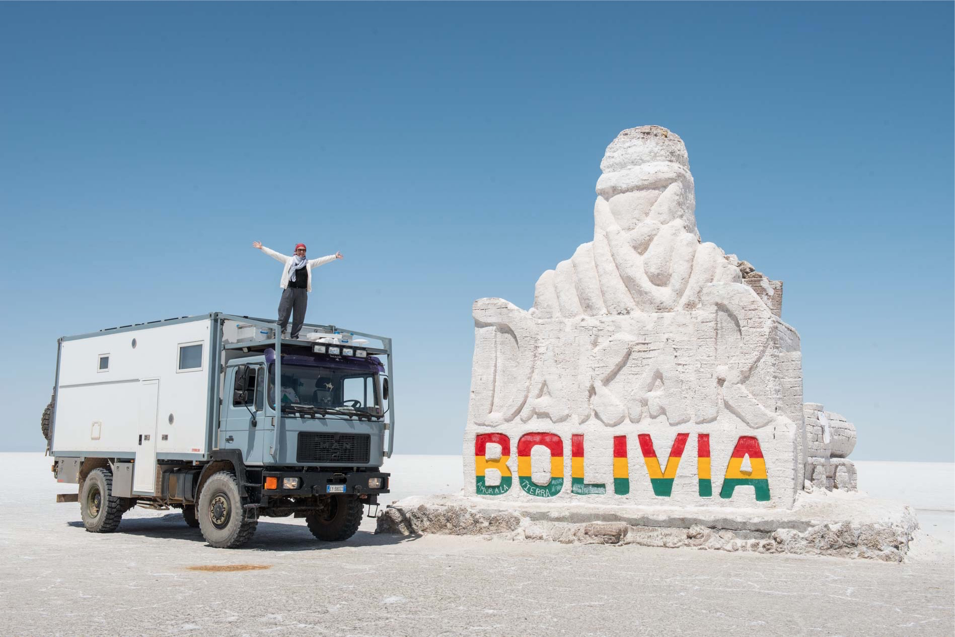
Take more information at Uyuni and understand that these slopes are part of a much wandering route from local agencies that take tourists to visit the most famous high-altitude water lagoon, the Laguna Colorada. They are all off-road trails that in about 500 km connect the Atacama Desert to Salar De Uyuni going through some of the most photographed places in Bolivia. Needless to say that we have now decided to go one of these, we just have to understand which one.
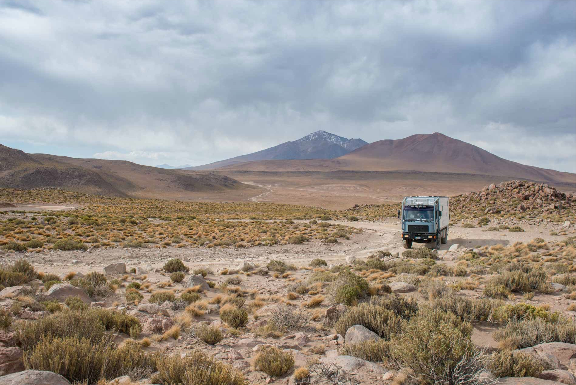
By analyzing the map more thoroughly we check that there are three alternatives to reach the Laguna Colorada, the one we call the South West Circuit, the Central and the Eastern Route. By comparing us with other travelers on the net we trace the differences on the map, identifying as the most significant the South West circuit due to the largest number of lagoons touched, for the maximum quota and for its particular proximity to the Chilean border where the mountains reach the altitudes more. All slopes eventually converge at Hito Cajon Pass, where the Green Lagoon and the White almost unite in the presence of the Licancabur volcano with its 5900 meters altitude is visible from every corner of San Pedro de Atacama.
As is often the case when looking for information on this type of networking, everything is said to be a way too difficult for anyone (apart from what he writes), who says he has easily walked along with a two wheel drive, who instead began to walk it and then went back. Talking with Tour Operators is totally useless because to make yourself nice or to persuade you to go with them, they tell you that the track is very difficult or even missed.
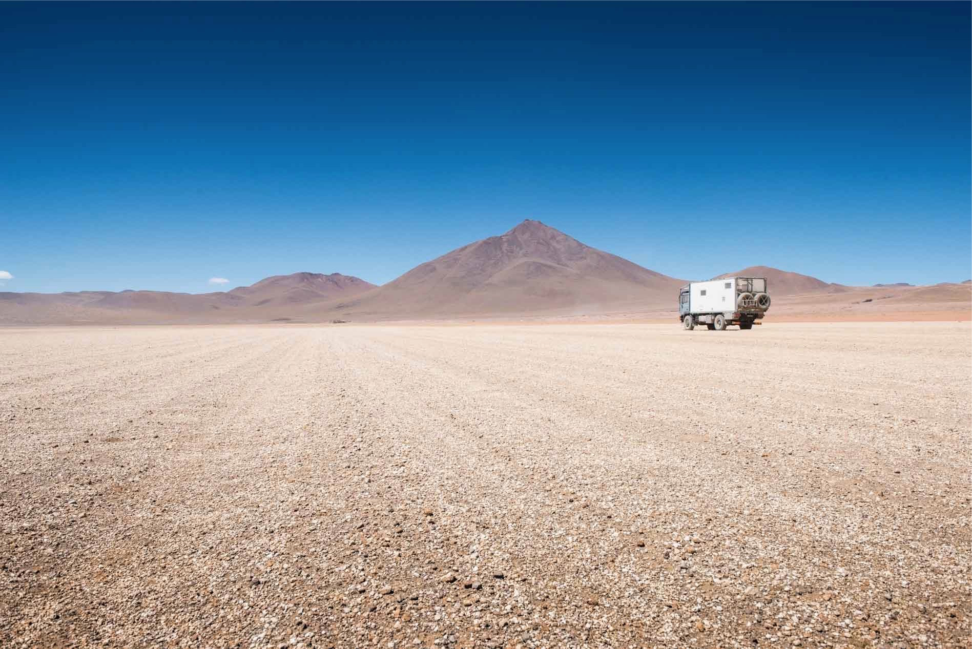
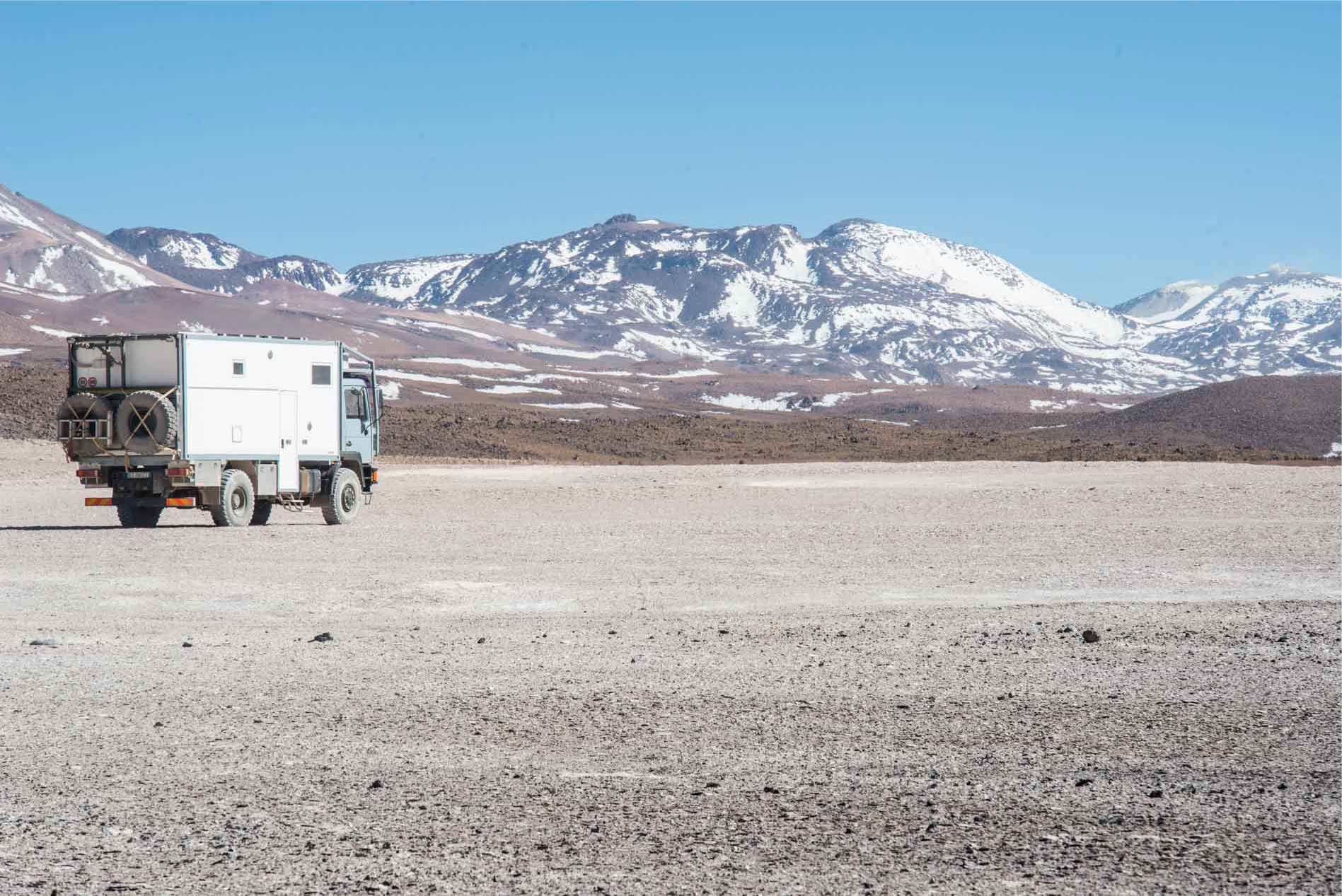
The idea we have made is basically this: it is a high altitude path between 4300 and 5000 meters and hence the temperatures can become stiff at night. The only fuel filling stations are Uyuni and San Pedro De Atacama, possibly with the option of buying gasoline (non-diesel) in San Cristobal, which is about 70 km from Uyuni. Although there are no villages between the beginning and the end of the itinerary, we do not feel that we will feel really alone, as the Tour Operators of Uyuni and San Pedro frequently ride the route. These during the itinerary are located at some points of the track where there are shelters, so far away from them during the night you will be in absolute solitude. No one travels at night on these slopes. However, the only way to find out how things really are is to make Diesel full and get on the go.
Day 1 – From Uyuni to the Hedionda Lagoon (207 Km)
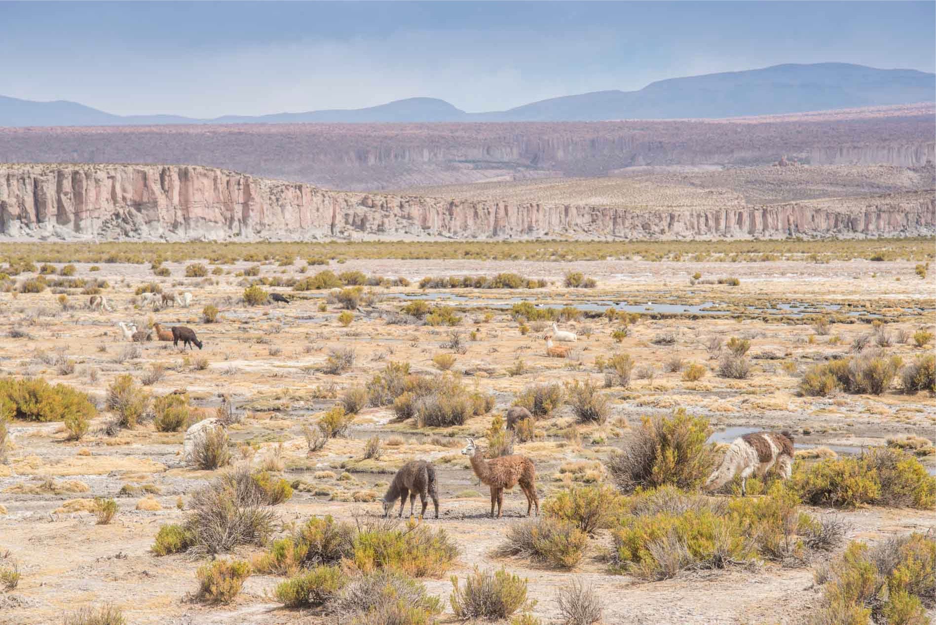
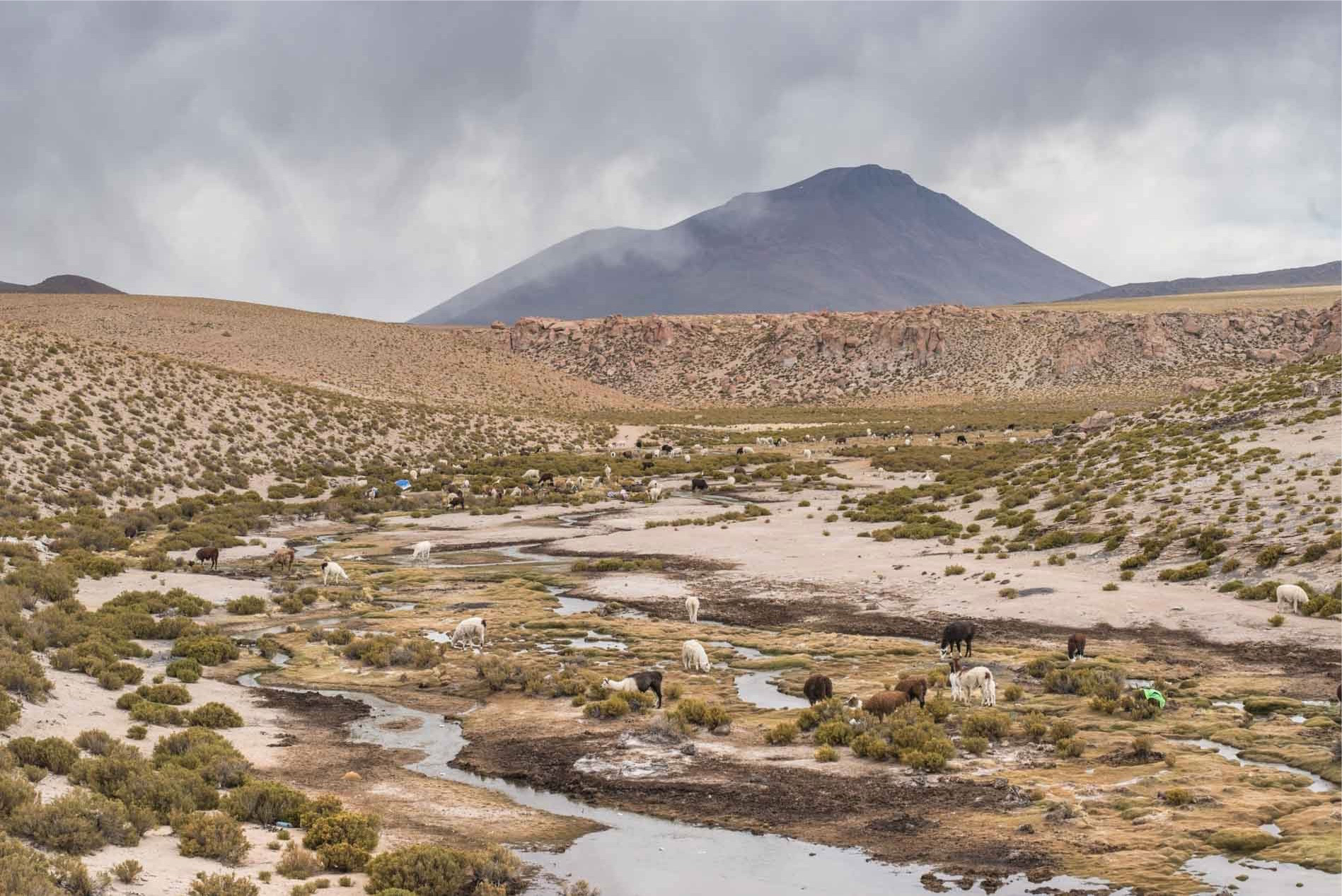
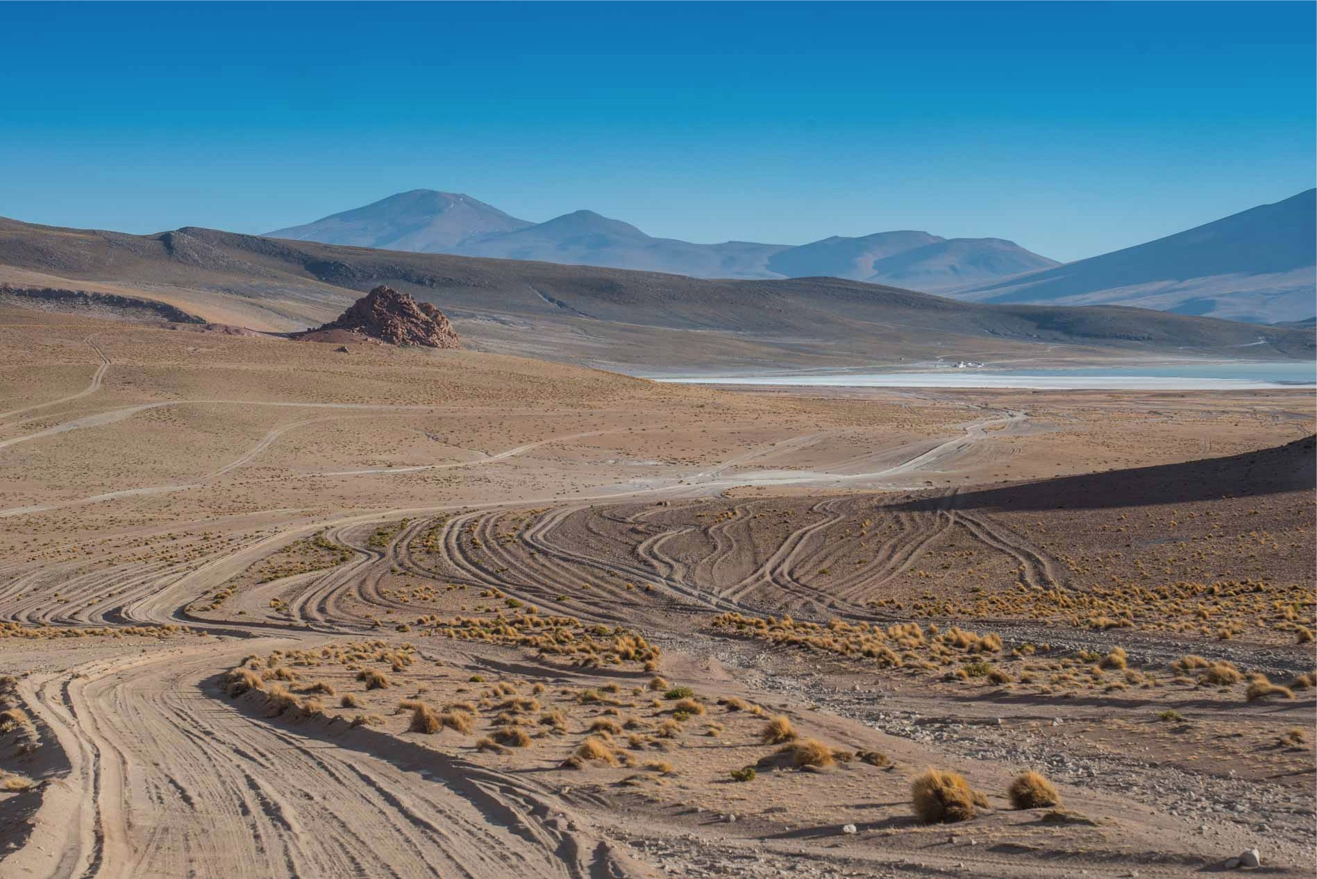
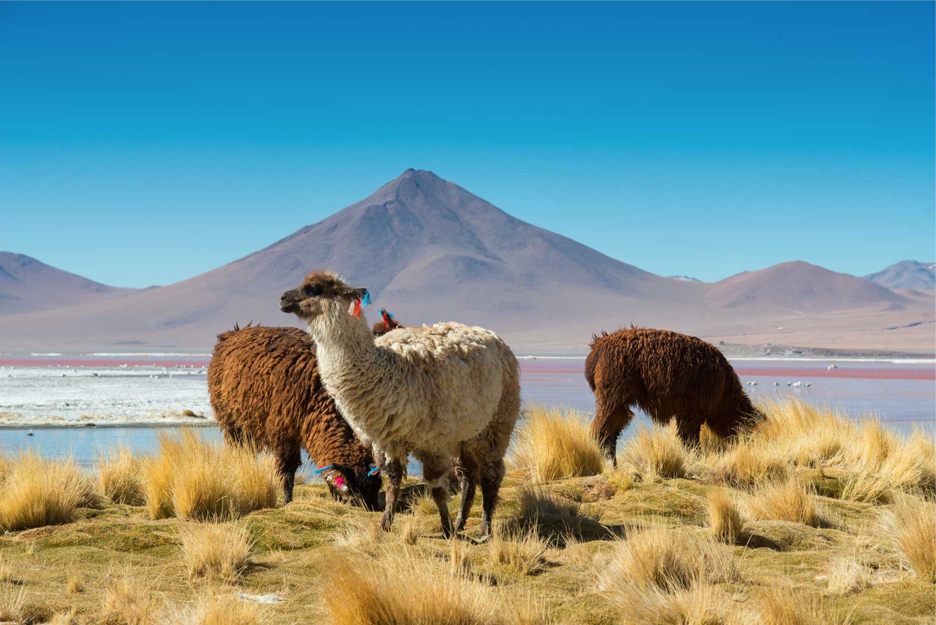
The first 100 km of track is better than half of the paved roads that have traveled to Bolivia today, a continuous strip of clay that cuts in two a desert panorma made of stones and orange-colored sand. The sky of a saturated blue color is pruned by small new ones that move fast because of the strong wind which at times also oscillates our truck. After to San Cristobal, the route rises slightly up to 4600 meters and descends again to 4300 where, crossing a snowy mountain range, crosses a long plateau full of watermills where they graze hundreds of Lama.
Here we cross the Eastern Route route, a compact sand rug that is lost in the plain on our left and then the Central Circuit, which peaks in a small throat and then loses its visuals far away from our gaze .
Just before leaving the main track that goes on down to the Salar de Chiguana then entering directly into Chile we cross a very strange rocky shape that looks like a work of art of nature, a sort of corridor stitched with red stones carved by the wind and stiffness of the climate.
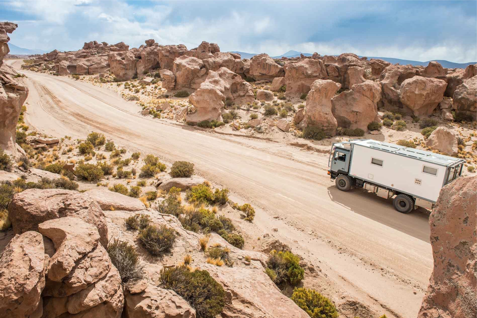
Beyond this strange landscape we find ourselves immersed in a new exciting landscape, though this time covered by threatening gray clouds and apparently filled with water. We are aware that the rain could especially increase the difficulty of the route especially when we leave the main track, but fortunately we will not have to experience this experience.
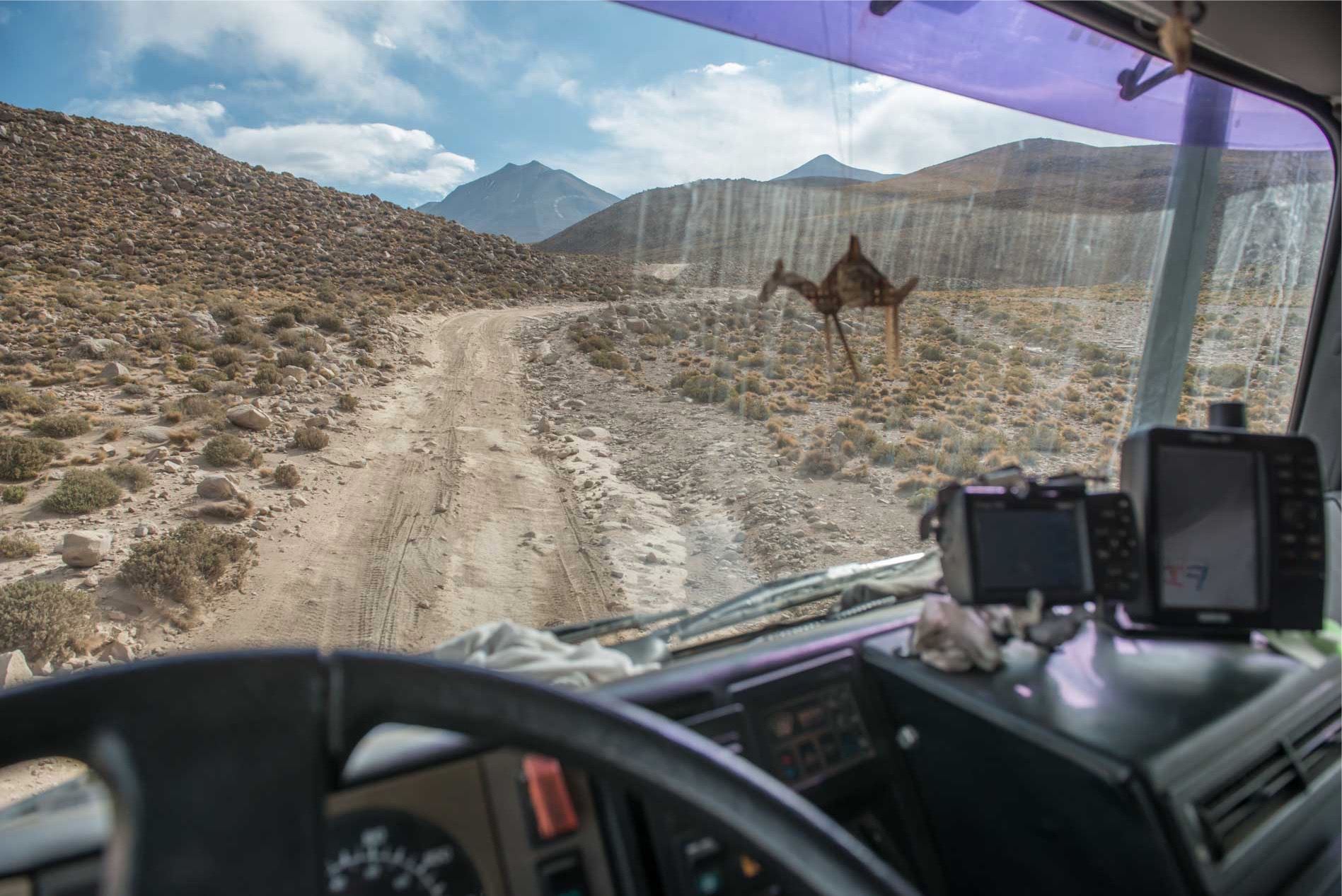
Approximately 15 km as the crow flies from the Chilean border (S21 23.972 W67 59.236) we leave the main track to approach the mountain on our left. The track from afar is just visible, the tracks leading to the mountain are dozens, but when we approach the rocky wall we find the path to follow.
While we enjoy driving on this narrow rocky path that after some hairpin turns us to 4600 meters above sea level we cross an off-road in the opposite direction, it’s a guide that accompanies some tourists who kindly stops to give us some directions. The first thing he says is: But your truck is great! then tells us that this first stretch of track is pretty hard, so many rocks and cracks in the ground caused by water, yet reaching the first lagoon the situation will definitely improve.
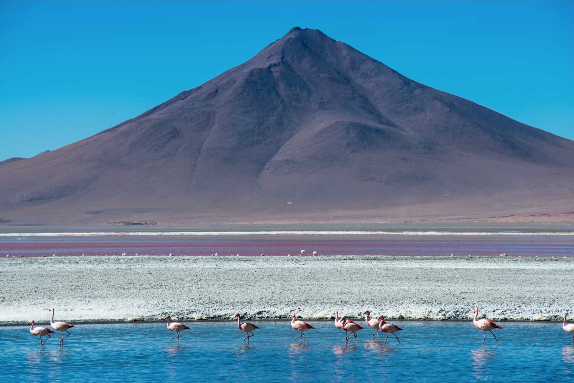
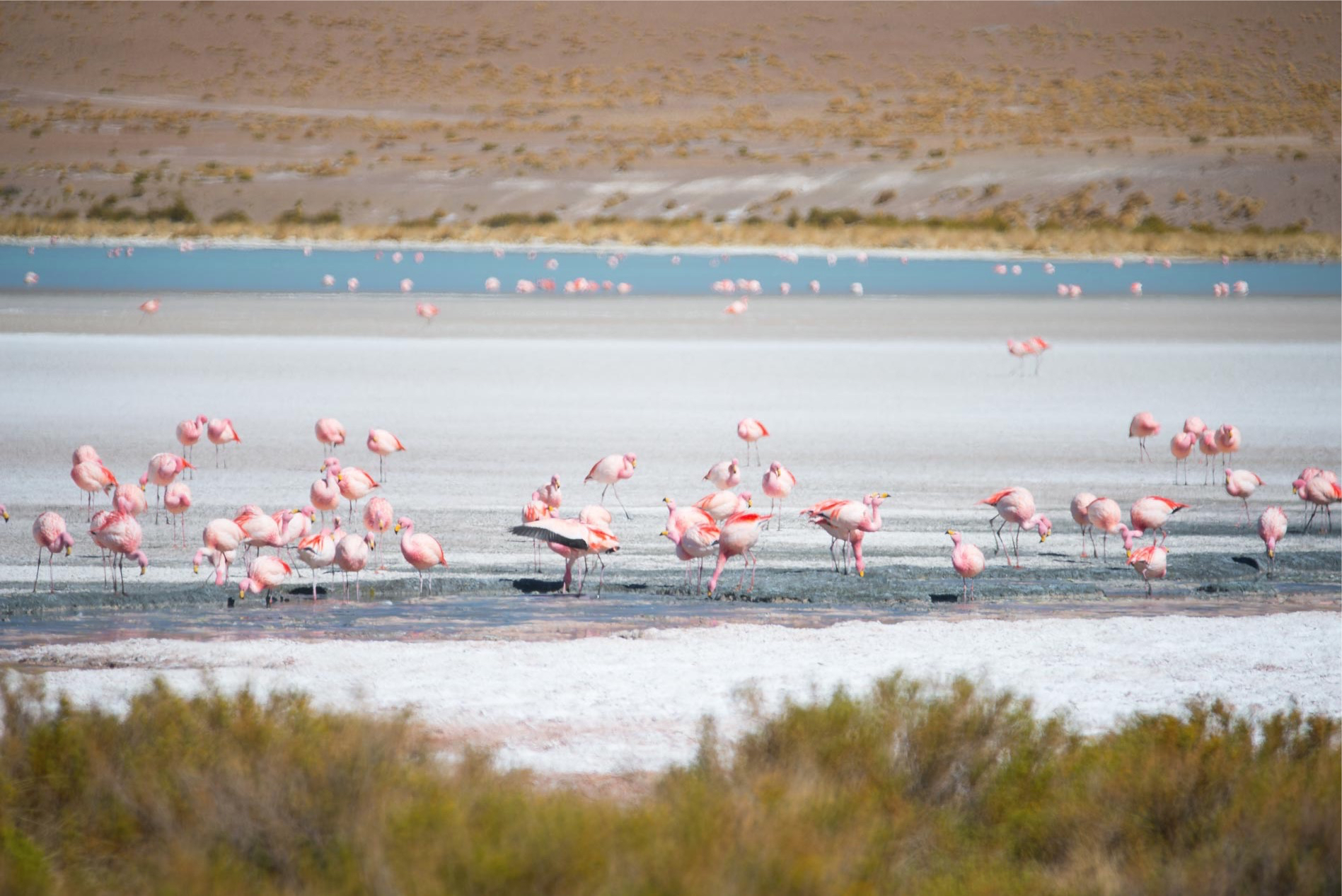
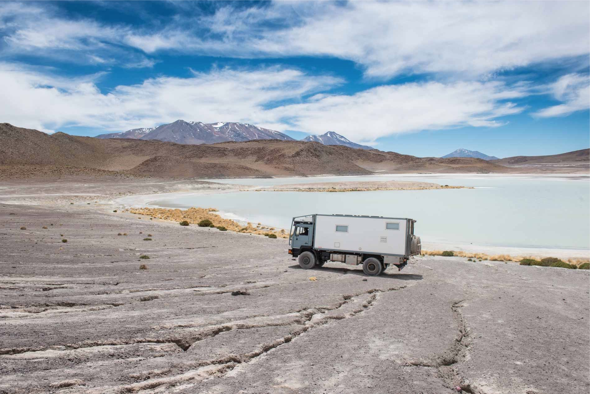
Slope is not small, but slowly we do not find it difficult to reach a flat area where the rocks will leave space to a much better track that in about 15 km will lead us to the lagoon Hedionda, the first mirror of populated by Pink Flamingos that we will meet along this impressive path immersed in Bolivian nature.
We will spend the first night on the Laguas Route at 4,300 meters altitude, admiring a sunset over the Hedionda Lagoon in all its beauty.
Day 2 – From Laguna Hedionda to Laguna Colorada (81 Km)
We notice that the night was colder than usual because of the fact that for the first time since we left for our trip the heating has decided to leave. We look at the temperatures reached and we find that we arrived at -12 at around 6am, which is somehow thought of by Diesel, as it may have been “frozen.” Fortunately we had left the truck with the tank exposed to the East, trying to gain some degree of temperature that would be able to heat up our fuel before departure.
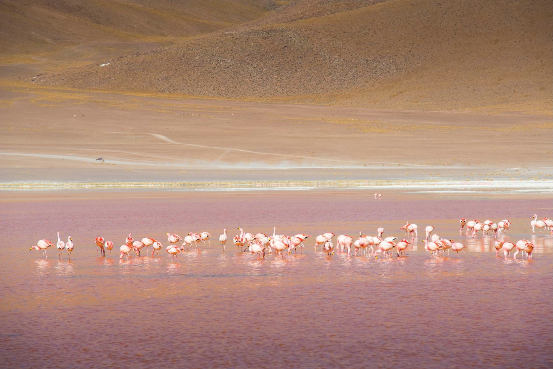
Before we worry about the Diesel, however, we enjoy this fantastic place that in full solitude gives us great pictures of the Flamingos trying to get food.
Fortunately, apart from some mumble more than usual, starting is a problem when, at around 11 o’clock, there are 8 degrees Celsius. So we continue our journey to Chile, reaching Laguna Chiar Kkota, where we encounter the first real difficulty for our truck.
The track climbs slightly on a ridge, but about halfway up, its width becomes dim due to a partial collapse to the valley. A smaller vehicle, driven by a person with a minimum of experience, would have no problem passing, but we with our 14 tons of cargo are reluctant. After a bit of analysis of the situation we understand that the only way to pass this track is to get around it looking for a step downstream. We do about 500 meters in reverse and start searching. Fortunately we find a passage very close to the lagoon that in about 800 meters off-road and a steep climb, but that is not a problem for Valentino’s reduced gears, it brings us beyond the obstacle.
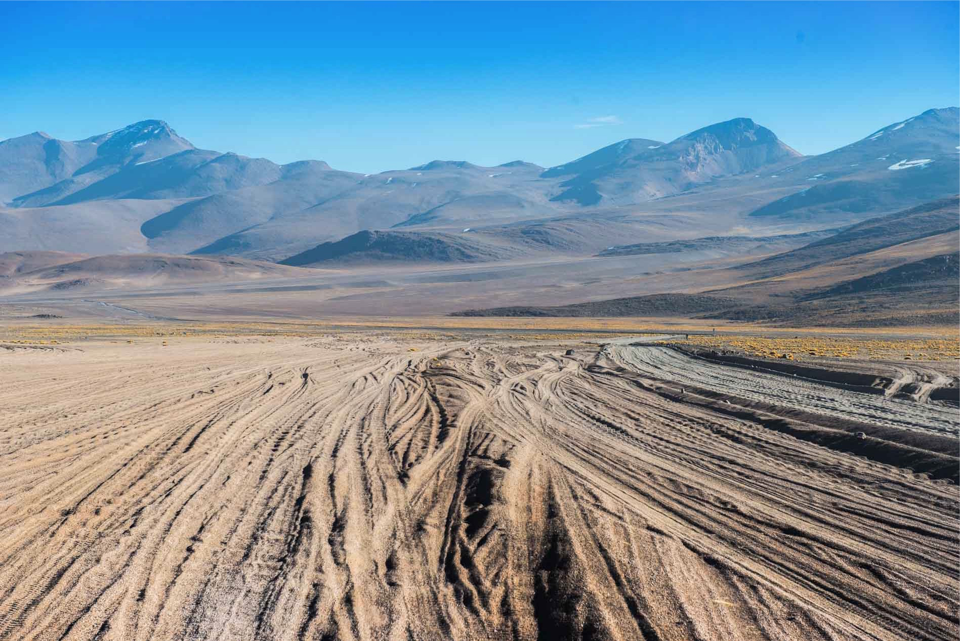
We are then riding on a plate plowed with earth and tiny stones, it seems to have come back a few months, when we were on the Maroccains slopes, here we gain a bit of travel speed until we see the real plague for every lover of off-road trails, the Tole Ondulee.

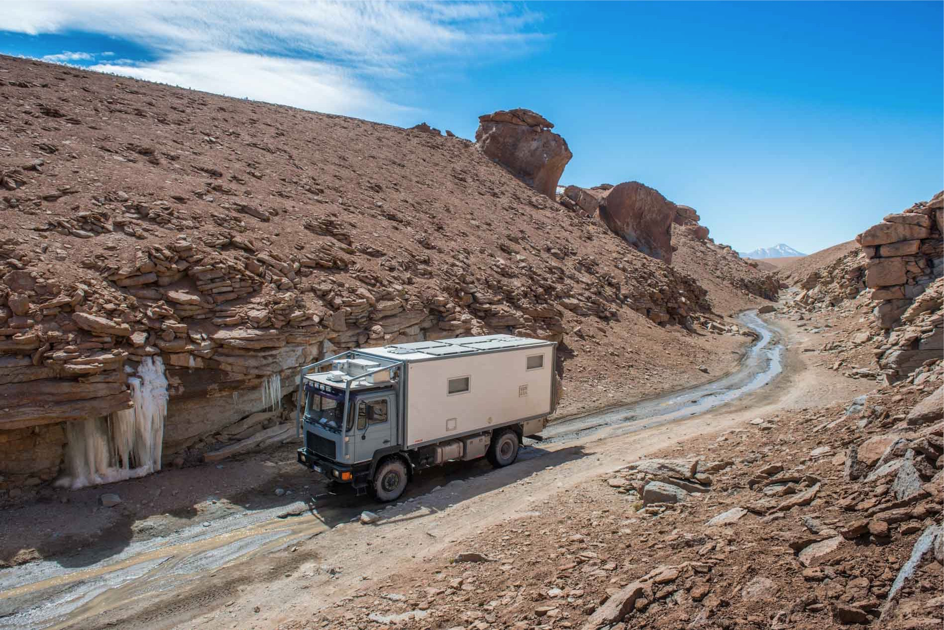
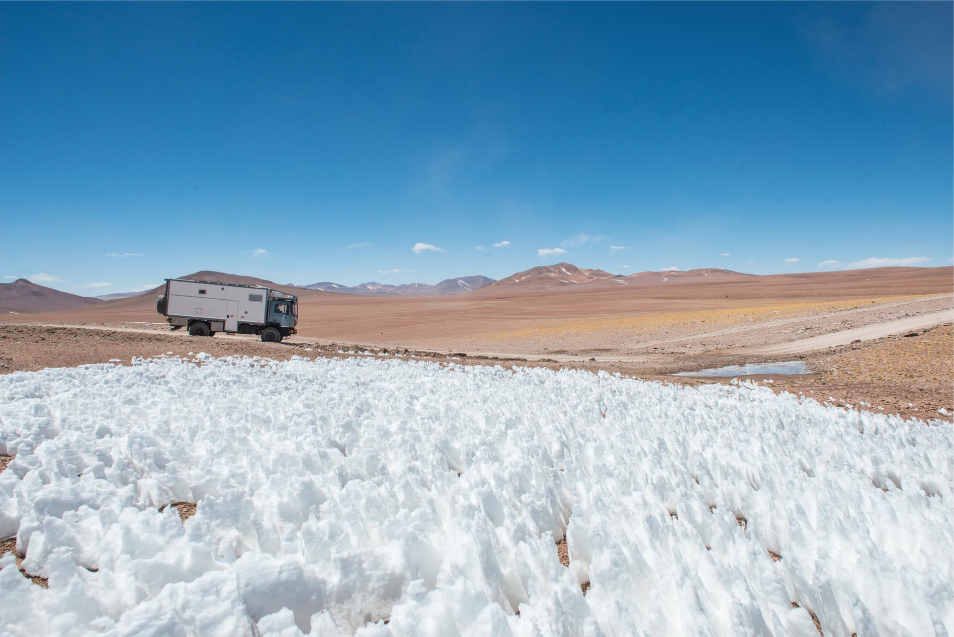
The compact sand that creates continuous and prominent ripples forces us to slow down a lot. Despite the rule of thumb on this type of terrain, say that the speed should be increased until the wheels are actually floating between the ripples and the other we prefer to slow down, as we are not in a hurry. But sooner or later the terrain under our wheels always changes, so the Tole leaves room for the rocks of a gorgeous narrow gorge that we will find later being a detour to the main track that instead continued somewhat lower in the valley. Valentino just passes in a couple of places where huge prominent rocks seemed to want to fall from the wall to our side. Here at 4600 meters, we find the first snow and huge ice stalactites.
After reaching the altitude of 4700 meters, the landscape changes again, we begin the descent towards Laguna Colorada and here we find the worst stretch of track, not difficult, but totally devastated by the Tole Ondule. Off-road trails seeking comfort from this situation that literally kills vehicle suspensions are lost everywhere, but it’s useless to look for survivors, every centimeter of rolling ground is covered with corrugated sand.
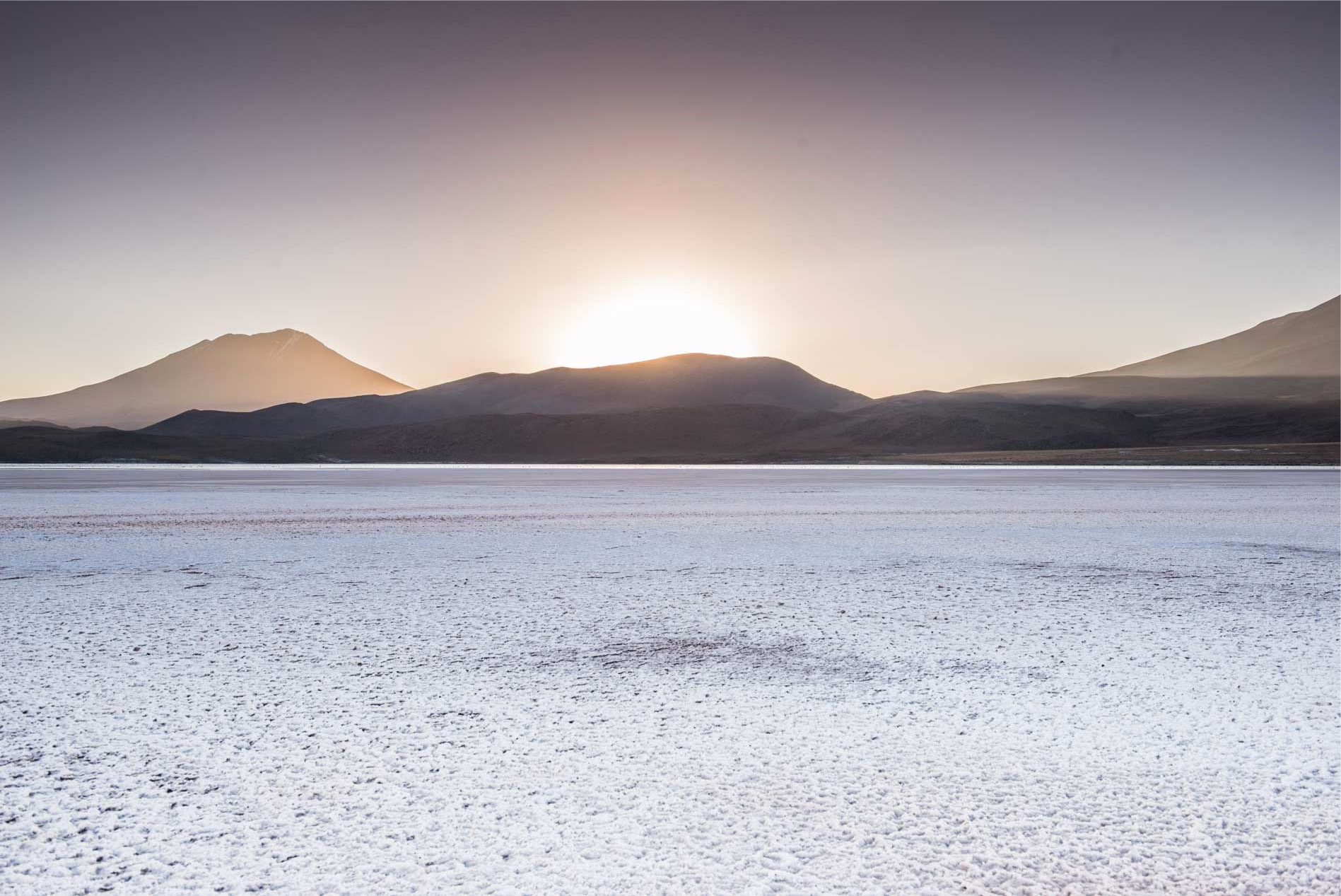
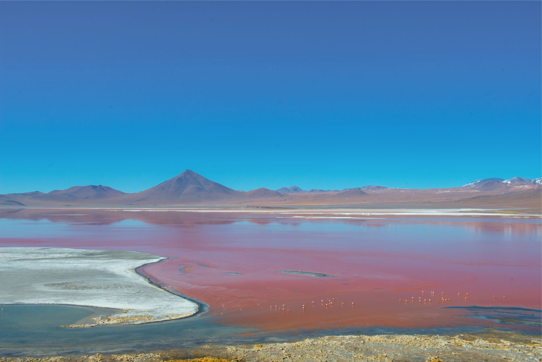
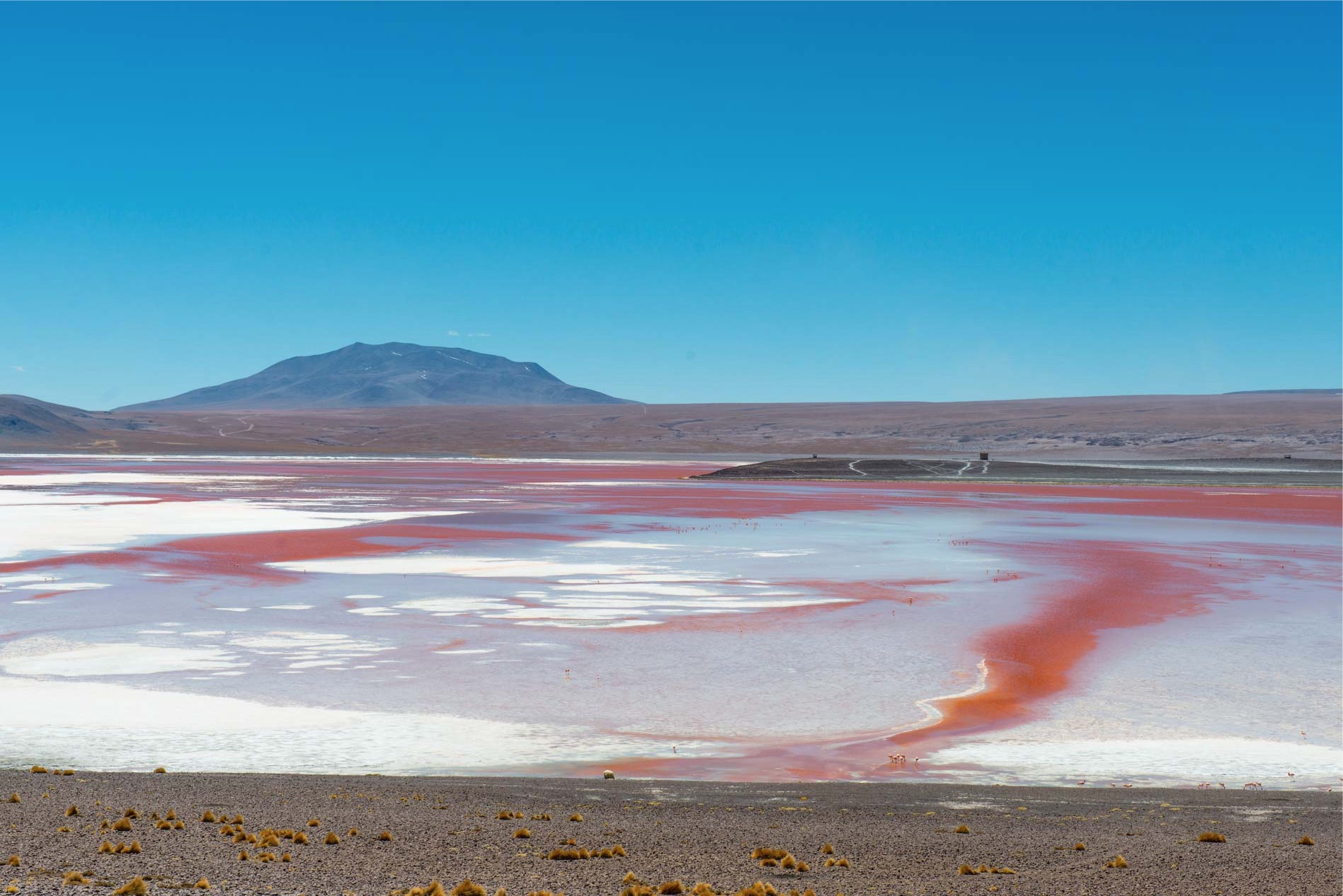
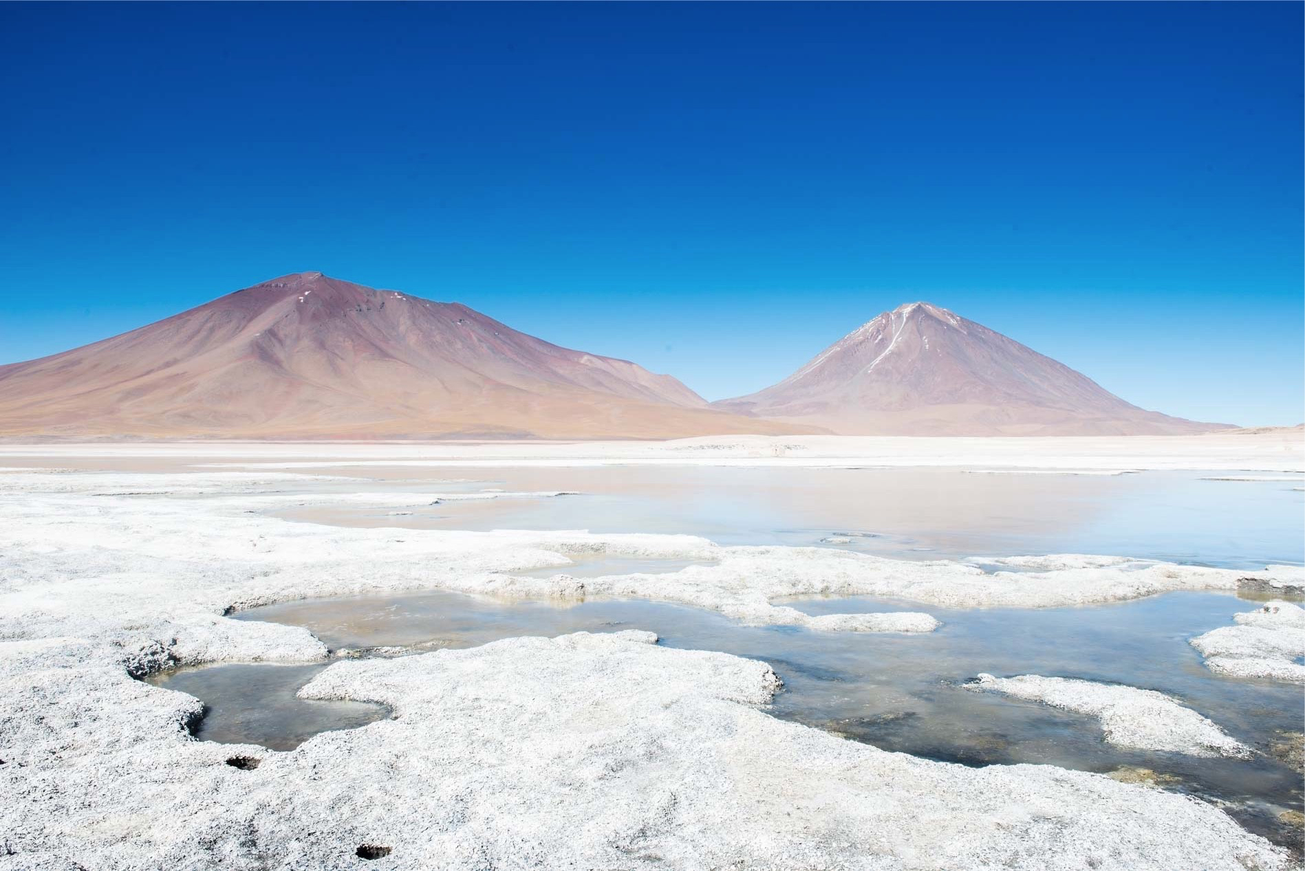
But when we reach the Laguna Colorada, completely deep red with white patches of salt and streaks from blue to yellow, we forget the fatigue made to reach it. We simply stay open to the place where we will spend the night, an altar that offers a privileged balcony for a unique show in the world.
Day 3 – From Laguna Colorada Lagoon to Green Lagoon (97 Km)
Still one night spent under a starlit sky, but still cooler than the previous one, since here at 4350 meters we reached -15 degrees. Inside our four-way home we do not notice much of the outside temperature, but as soon as we open the door a stinging cold penetrates our skin, making us choose for heavier clothing.
We spend a couple of hours strolling along the lagoon even though the wind is scarce when we have to climb uphill. We enjoy the show of knife gathering on an islet and eat grass while the flamingos start to wake up one night past one to the other to find relief from the cold.
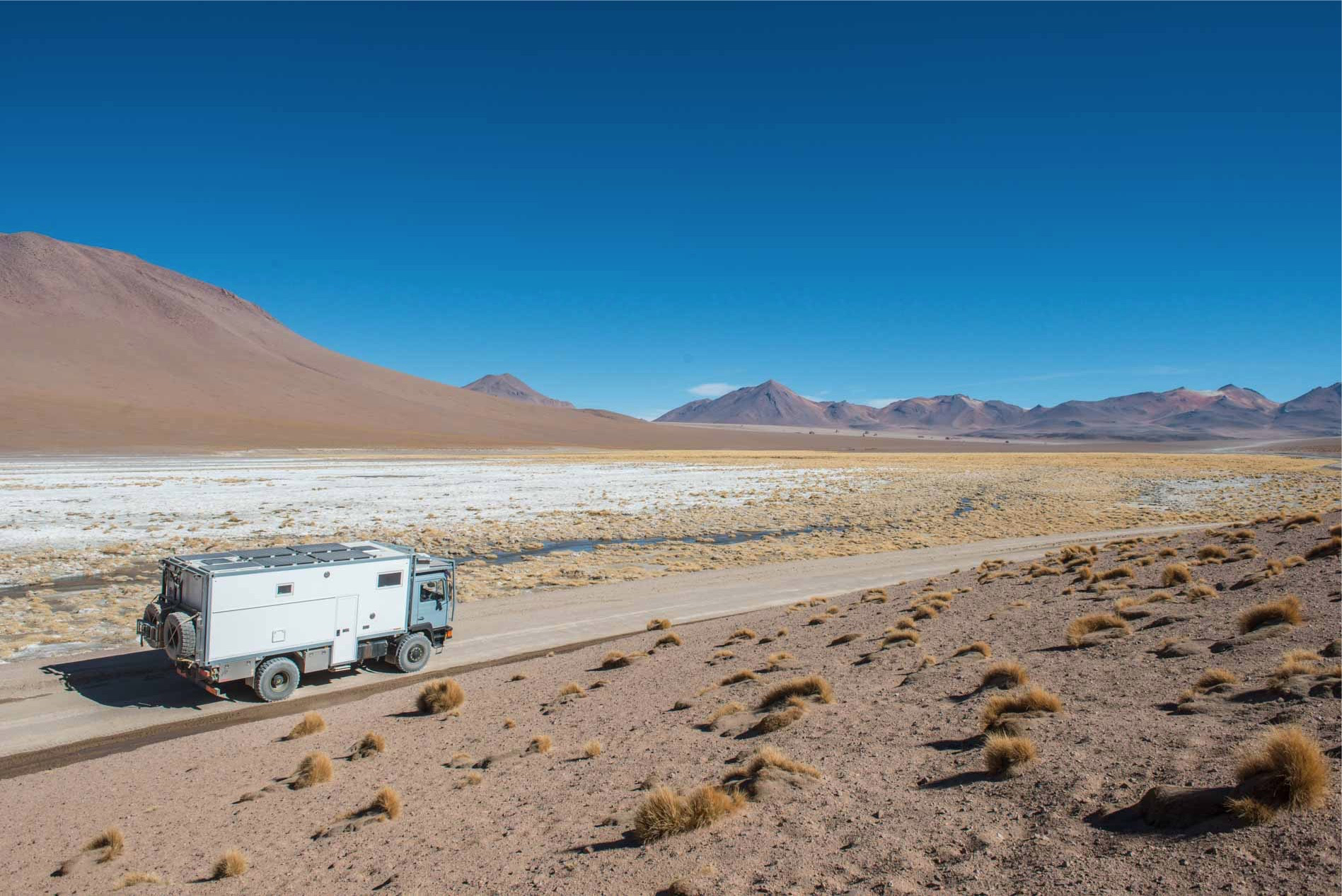
We are so sorry to leave this place, but the way to go is still so much and there are still so many things to see. Valentino starts to run smoothly, this time with his main sunbathing tank, which is not too late to warm up. With the Colorada Lagoon behind us we enter into a huge gravel high plateau. The mountain in front of us seems an imposing obstacle to the track, but we see from the map climbing a ridge and then throwing it from the opposite side. We are expecting an ascent balloon, which in fact does not make much to show up in front of us.
When you reach the 4,800 meters of altitude we find ourselves in a stunning stretch of track running through a rippled ridge, the low bushes appear to disappear under the sand that has become much finer and chewed by the wind. It seems unbelievable to be at such an altitude and to go along a whole track so flat. At 4900 meters we touch snow again, this time we also put the wheels on top so to try the taste.
Getting out of the cab is difficult, the wind seems to want to take away any form of life within tens of miles, but of course we do not take the chance to take a shot in the middle of such an enchanting panorama for the our eyes.
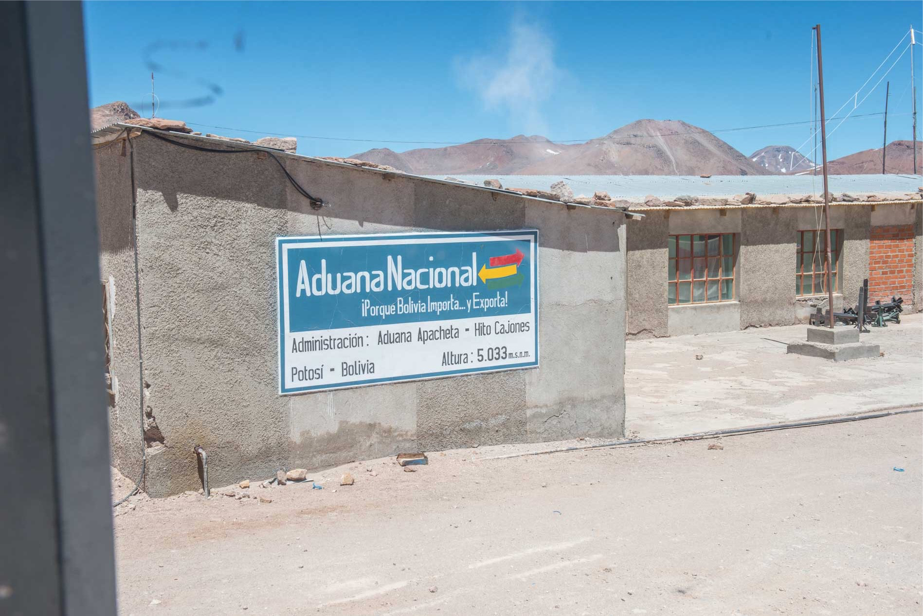
Bolivia had astonished us for the peculiarity of its frontier at the entrance and did not stop doing it at the exit. Fortunately, we found out that we should have made customs controls for the exit from the country at the customs office located on the Hito Cajones Borico acid extraction site, which is of course not long on the track but needs to be reached deviation of 5 km leading to 5000 meters.
Hurry up the fast customs formalities we head to a new interesting site, the one of the Gayser at 4900 meters and needs a new small deviation from the main track. This turns out to be a bit stingy and not very easy to travel, but of utmost value to the eye.
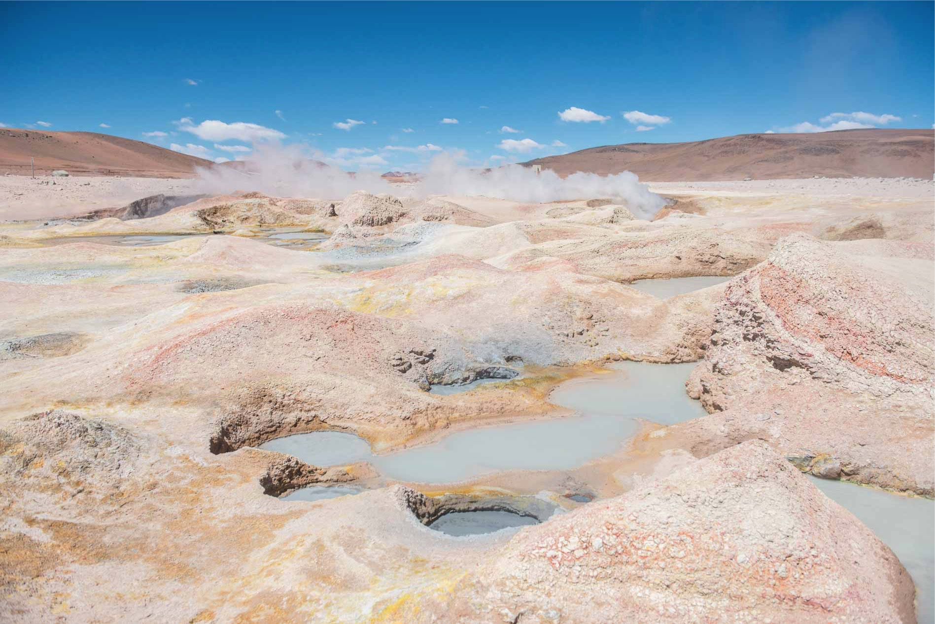
Speed up the fast customs formalities we head to a new interesting site, that of the Gayser at 4900 meters and needs a new small deviation from the main trail. This turns out to be lightly stony and not easy to travel, but of utmost value to the eye.
Continuing, you cross the region of the Dalí rocks, strange conformations of stones that seem raining from the sky just above a vertical stretch of fine sand of an intense yellow color.

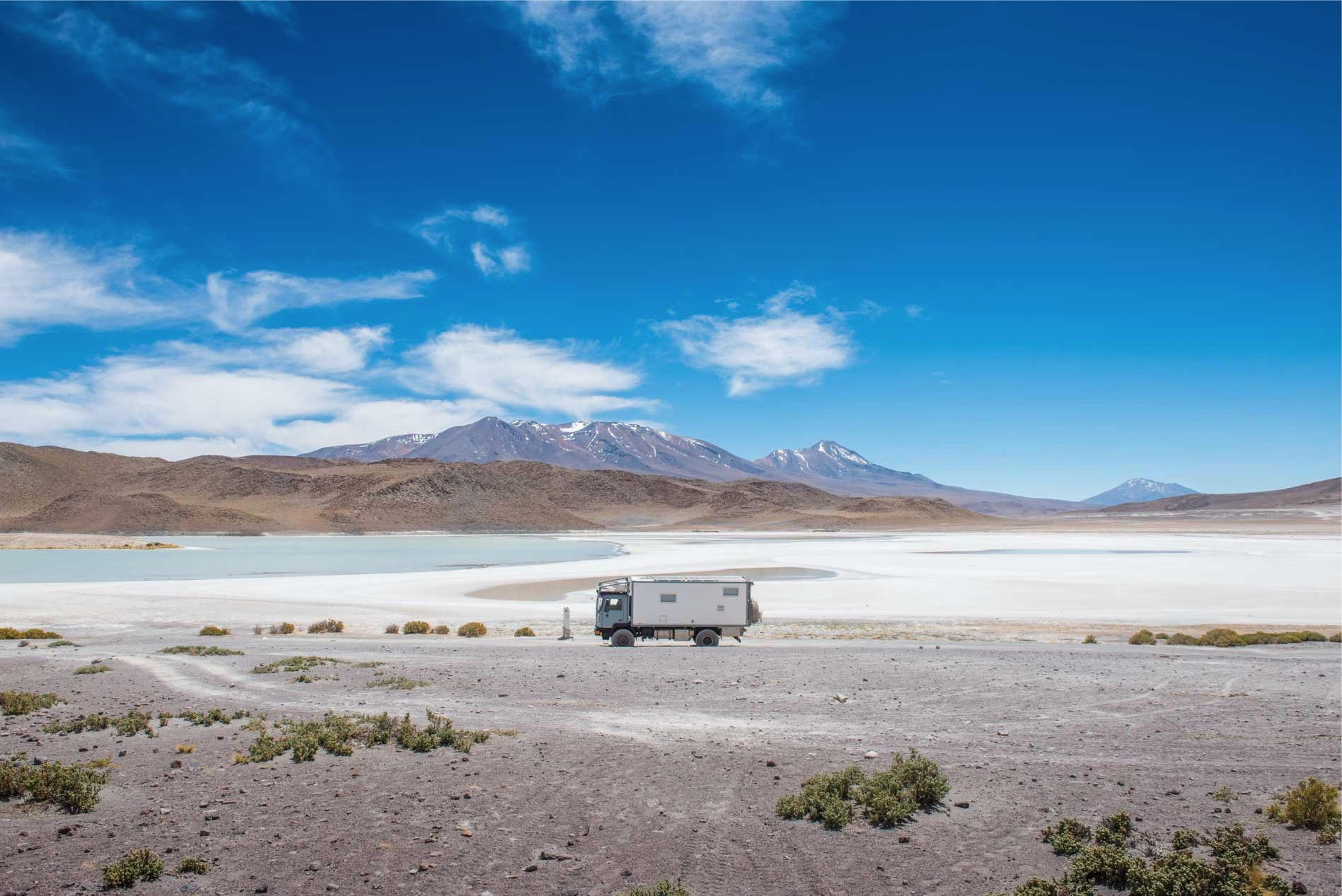
From here the track improves considerably, looks almost flat and leads us quickly to the place where the Laguna Verde and Bianca are separated only by a thin white sandy language and where the Licancabur Volcano shows itself proud of its altitude that exceeds the 5900 meters.
From here the track improves considerably, looks almost flat and leads us quickly to the place where the Laguna Verde and Bianca are separated only by a thin white sandy language and where the Licancabur Volcano shows itself proud of its altitude that exceeds the 5900 meters.
Let’s just wake up Valentino’s engine and drive us to the frontier, which – having already done customs checks about 50 miles ago – will be limited to a passport stamp. So it happens and in short we are 4600 meters where entering Chile we find the asphalt.
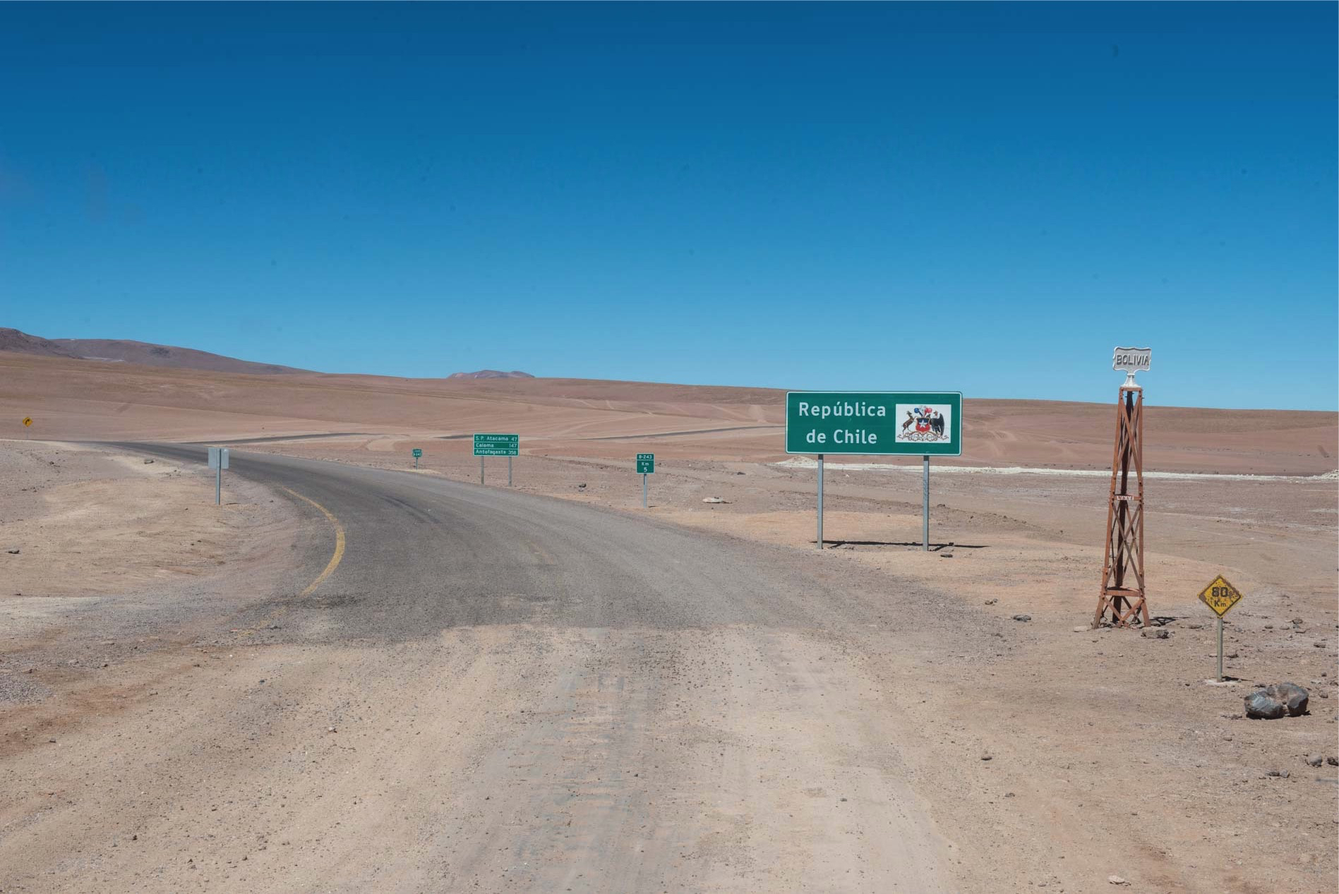
From here in San Pedro De Atacama, which is at 2400 meters altitude in practice it is all a great descent. From a distance of miles you can admire the Atacama desert and slowly we lose that part here that temperatures rise.
Final considerations
The Laguans Route is undoubtedly one of the most beautiful roads we have traveled to, we did not find it complicated by its conditions, but it is certainly difficult because of the Tole Ondulee and the rocky tracts that cause foresight and disappointment driving. Surely the guidance on any SUV would have been more enjoyable at certain times, but the nights spent in our home with the window overlooking some of the most suggestive places on the planet, instead of inside the room of a haven, we believe we have repayed of the slowdown. But what to say, it is the desert, an extreme state by nature and so it must be taken for what it is. We have read some travelers complain about track conditions, without finding justification at the cost of 150 Bolivianos per person needed to enter the park where Laguna Colorada is located. It seems to us that some complaints are absurd, given the geographical location of the territory, the fact that it is a protected park area and where it is therefore necessary to respect the flora and fauna of the place. Thinking of an asphalt road in this place would seem as a minimum an abuse of power over the surrounding nature. By motorbike? Durable for the demand for autonomy, for sand always present and for temperatures. Surely the summer would be more appropriate, however, a certain degree of familiarity with off-road driving is required.